Tahrir Square
📍 Get there
Coordinates: 30.0444, 31.2358
Tahrir Square (Midan al-Tahrir, "Liberation Square") is the centre of modern Cairo. It was laid out in the 19th century under Khedive Ismail as part of his new European-style city, and took its present name after the 1952 revolution.
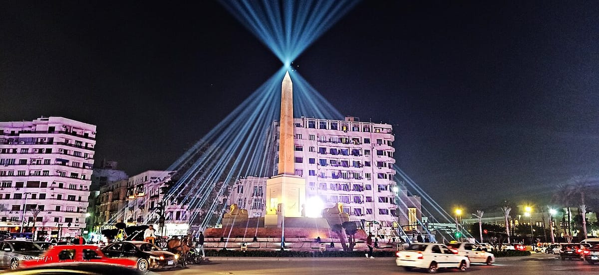
In 2011 it became world-famous as the heart of the protests that ended President Mubarak's rule. In 2020 the square was redesigned: an ancient obelisk of Ramses II, brought from the Delta site of Tanis, now stands at its centre, surrounded by four ram-headed sphinxes moved from Karnak in Luxor.
Around the square are some of Cairo's best-known buildings - the pink Egyptian Museum, the old campus of the American University in Cairo, the Omar Makram Mosque, and the huge Mogamma government building.
Highlights
- The Ramses II obelisk and the four ram sphinxes
- The Egyptian Museum on the north side
- Downtown's belle-époque streets leading off the square
- Walk across Qasr al-Nil Bridge to Zamalek
Visiting
- Opening hours: open at all times; the obelisk is lit at night
- Getting there: Cairo Metro to Sadat station, directly under the square
- Traffic: cross only at lights or through the underpass - traffic is heavy
- Nearby: Egyptian Museum, Abdeen Palace, Cairo Tower